Swargarohini Trek


Swargarohini Trek “Way to Heaven”
Swargarohini Trek is a mountain group of four peaks in Garhwal Himalayas of Uttarakhand. It is known as “Way to Heaven.” Altitude is -17,987 feet located at Chamoli district in Uttarakhand
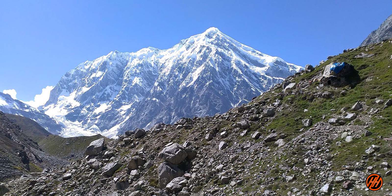
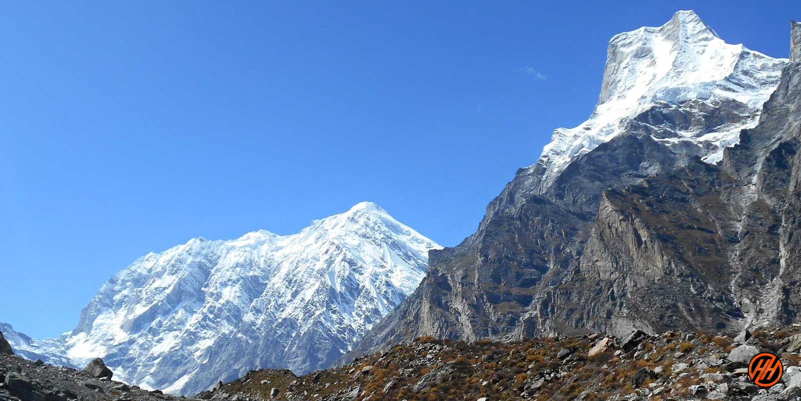
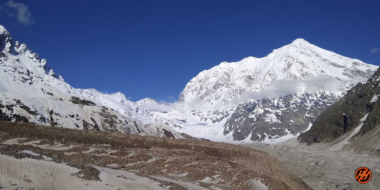
Feast your eyes with the views of entire Chaukhamba Peaks and Kuber Parvat with other high snow-capped mountains.
Swargarohini Trek is a mountain group of four peaks in Garhwal Himalayas of Uttarakhand. It is known as “Way to Heaven.” Altitude is -17,987 feet located at Chamoli district in Uttarakhand
Feast your eyes with the views of entire Chaukhamba Peaks and Kuber Parvat with other high snow-capped mountains.
History of Swargarohini trek
According to the legends, Pandavas took this route while their ascent to heaven. Only Yudhishthira (one Pandavas) and a dog were able to reach heaven. All the other Pandavas died on the way.
As per legends belief, Swargarohini is the only path from where one can reach heaven in human form.
Satopanth, the sacred lake lies Chaukhamba massifs. It believed that Lord Brahma, Vishnu, and Mahesh took a bath in the waters of this Lake, so it is considered holy and pure.
Devotees believe that a holy dip in Satopanth Lake will wash away so every year thousands of people visit this place.
Pass-Through These Picturesque Places
The starting point of this trek is Mana, and the trail further leads to famous Vasudhara followed by crossing a glacier named “Dhano.” Pass through Laxmi Van which is a thick forest, en route are caves where saints live permanently.
Ahead reach the serene Satopanth Lake and spend time in the divine vicinity. Further, lie Chandrakund and Suryakund with a different mythical story.
About Base camp Joshimath
It is a picturesque town in Chamoli at an altitude of 1875 m nestled amid high Himalayan peaks. It is the base camp of 10 above Himalayan treks and the gateway to famous pilgrim sites like Badrinath Dham and Hemkund Sahib Ji.
There is spirituality in the air because of the presence of ancient temples. It is home to one of the four “Math” “Atharva Veda” by Adi Shankar Acharya. Joshimath has tranquil charm away from the cacophony of cities.
The gushing rivers and silent streams with the cover of verdant green and the pious ancient temples in the area will surely lure you to come here again and again.
Why To Choose Swargarohini Trek?
Before heading towards the itinerary, it is really essential to perceive the reason behind choosing Swargarohini trek.
See firstly, the trekking distance is a total of by taxi 680 Km both side and on foot 78 km which is to be covered into 13 days. . Dehradun to Dehradun
Swargarohini trek is a high altitude mountain trek Altitudes is 17,987 feet
The Starting trail is moderate as compare to other treks this is difficult trek. So this trek is not for beginners
Need proper gear & clothing for sub-zero temperature?
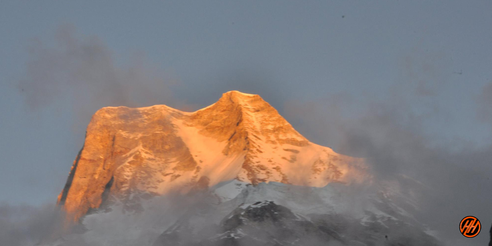
You got to see so many heavenly bodies at one place like the panoramic view of the Himalayan ranges, you can see pine forests, different variety of flora and fauna surpassing through bona fide Garhwali culture.
I think Do spare time in Interaction with our local’s team, and you will get to know about some of the ancient Tales of Indian mythology and our local cultures, this is good ideas for trekkers
Beautiful landscapes so carry proper photo gear & Extra battery backup.
The backpack should not exceed 12 kg only
Trekker carry your Photo ID , Adhar card , Passport , Visa , for entry at forest check posts on the trek it is very important
Alcohol and non-Veg and smoking is not allowed in during the trek
Before heading towards the itinerary, it is really essential to perceive the reason behind choosing Swargarohini trek.
See firstly, the trekking distance is a total of by taxi 680 Km both side and on foot 78 km which is to be covered into 13 days. . Dehradun to Dehradun
Swargarohini trek is a high altitude mountain trek Altitudes is 17,987 feet
The Starting trail is moderate as compare to other treks this is difficult trek. So this trek is not for beginners
Need proper gear & clothing for sub-zero temperature?
You got to see so many heavenly bodies at one place like the panoramic view of the Himalayan ranges, you can see pine forests, different variety of flora and fauna surpassing through bona fide Garhwali culture.
I think Do spare time in Interaction with our local’s team, and you will get to know about some of the ancient Tales of Indian mythology and our local cultures, this is good ideas for trekkers
Beautiful landscapes so carry proper photo gear & Extra battery backup.
The backpack should not exceed 12 kg only
Trekker carry your Photo ID , Adhar card , Passport , Visa , for entry at forest check posts on the trek it is very important
Alcohol and non-Veg and smoking is not allowed in during the trek
Altitude we are going to cover
ATM Point & Mobile connectivity
ATM POINT: Joshimath or Badrinath has the last ATM point.
ATM POINT: Joshimath or Badrinath has the last ATM point.
Mobile Connectivity
All networks will be available at Joshimath or Badrinath, BSNL, Vodafone and Airtel networks are available, depend on the signal strength. So finish all your important calls and work before starting of the trek.
All networks will be available at Joshimath or Badrinath, BSNL, Vodafone and Airtel networks are available, depend on the signal strength. So finish all your important calls and work before starting of the trek.
Key Points Swargarohini trek
Duration: – 12 Nights 13 Days from Dehradun to Dehradun
Base camp: – Joshimath Market
Summer Temperature: – Day (5°C to 15°C) Night (6° C to 12° C)
Swargarohini base camp – Altitude: – (17,987 feet)
Best Time: – May, June, September, October
Trek Level: – Difficult
Trek distance: – On foot 78 Km – By taxi 680 km
Group Size: – 12 people
Short Itinerary Swargarohini Trek –
Day 1– Drive from Dehradun to Joshimath Altitude – Joshimath by taxi (256 Km) (10/11 Hours) (1,875 m/ 6152 feet)
Day 2- Drive from Joshimath to Badrinath by taxi (48 km) (2/3 Hours) Reach hotel need proper acclimatization
Day 3- Trek from Badrinath to Laxmivan (08 km) (4/5 Hours) (12,510 feet)
Day 4- Trek from Laxmivan to Chakratirth (10 km) (5/6 Hours) (13,655 feet)
Day 5- Trek from Chakratirth to Satopanth Tal (05 km) (4/5 Hours) (14,755 feet)
Day 6- Trek from Satopanth Tal to Chandrakund trek (06 km) (5/6 Hours) (16,578 feet)
Day 7- Trek from Chandrakund to Suryakund (07 km) (5/6 Hours) (17,255 feet)
Day 8- Acclimatization Day
Day 9- Trek from Suryakund to Swargarohini base camp (17987 feet) back to camp (06 km) (6/7 Hours)
Day 10 – Trek from Suryakund to Satopanth Tal (13 km) (7/8 Hours) (14,755 feet)
Day 11- Trek from Satopanth Tal to Laxmivan (15 km) (7/8 Hours) (12,510 feet)
Day 12- Trek from Laxmivan to Badrinath (08 km) (4/5 Hours) overnight stay hotel
Day 13- Trek from Badrinath to Dehradun by taxi (380 km) (11/12 Hours)
- Get link
- X
- Other Apps
- Get link
- X
- Other Apps
Comments
Post a Comment