Himalayan Hikers is the most Trusted Trekking Community and Organisation in India. We have been working in the Adventure Area with a Experience and Knowledge since 1990.
Search This Blog
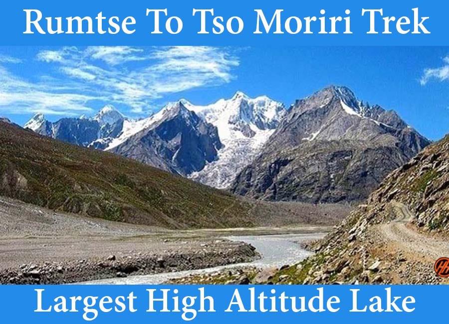
Rumtse to Tso Moriri Trek The Largest High Altitude Lake Trek
Rumtse to Tso Moriri Trek: The Largest High Altitude Lake in the Himalayas
Rumtse to Tso Moriri Trek lies in the Jammu and Kashmir region. Tso Moriri is the largest high altitude lake within Ladakh covering 40 km flanked by the Greater Himalayas and Trans Himalayas.
The trek from Rumtse to Tso Moriri is one of the most picturesque treks in Ladakh. The trail passes through the Changthang region; it is a plateau with exotic landscapes and unique lakes like Tso Kar and Tso Moriri.
The Legend Behind Rumtse to Tso Moriri Trek
The interesting story behind Tso Moriri’s name is — A Chomo (Buddhist nun) woman was riding on a Yak and somehow got carried into the lake, the Yak started drowning into the water and the scared woman cried “Ri Ri” for help until she drowned. Then the lake got its name “Chomoriri”.
Hampta Pass If you're dreaming of an unforgettable Himalayan adventure, the Hampta Pass Trek should be high on your 2025 bucket list. I’ve done this trek twice—once during a dry, sunny week in 2022, and again in a mist-covered wonderland in 2024. But what’s ahead in 2025? After going through recent weather models, official updates, and speaking to a few locals in Jobra and Chhatru, I can confidently say: this year brings some unique changes you need to know before lacing up your boots. Weather Changes in 2025: Expect the Unexpected The weather patterns over the Pir Panjal range are shifting subtly but significantly. According to IMD data and localized weather forecasts for Lahaul & Spiti , here's what trekkers can expect: Early Season (May to Mid-June): Colder than usual with unpredictable snowfall around Balu Ka Ghera and Hampta Pass. Expect daytime temperatures to hover between 5°C and 10°C , and nights can drop to -5°C . Peak Season (Late June to August): Milder da...
Kuppar Bugyal Trek a Hidden Trek in the Pabbar Valley The Kuppar Bugyal Trek lies in the Pabbar valley of Himachal Pradesh at an altitude of 3200 m. The trek starts from Khadapatthar which lies 70 km away from the picturesque town of Shimla. Beginners and Family trek in the Himalayas It is an easy trek for beginners and families; if you are looking for a Himalayan trek to start with or you want to explore the rich vegetation and witness scenic views then Kuppar Bugyal is the best trek for you and your family. Astounding Trail of Kuppar Bugyal Trek Go through areas highly rich in vegetation, the forests have abundant trees of Cedar, Deodar, Pines, and Rhododendrons. The greenery accompanies you throughout your journey. On the way come across the source of Giri Ganga River, it originates below the Kuppar Bugyal (meadow). Kuppar top offers great views of Pabbar valley and high Himalayan peaks. Key Points of Kuppar Bugyal Trek Level: Easy Proper con...

Comments
Post a Comment